Mount Givens is a peak in the John Muir Wilderness near Kaiser Pass. It is a moderate hike from the White Bark Vista point and provides excellent views of the central Sierra Nevada Mountains. I hiked this with Alexa and Heidi the dog on July 19th, 2020.
Alexa, Heidi, and I spent the night at White Bark Vista and hiked Mount Givens in the morning. See this post for a description of White Bark Vista and a bunch of pictures.
Stats:
Location: John Muir Wilderness near Kaiser Pass
Mileage: 5.6 mile round trip
Elevation Gain: 1,682 feet
Summit Elevation: 10,643 feet
Useful Links:
Driving Directions to Trailhead (Google Maps)
Summit Weather Forecast (Weather.gov)
Kaiser Pass Road Status (Forest Service)
More Info (Summit Post)
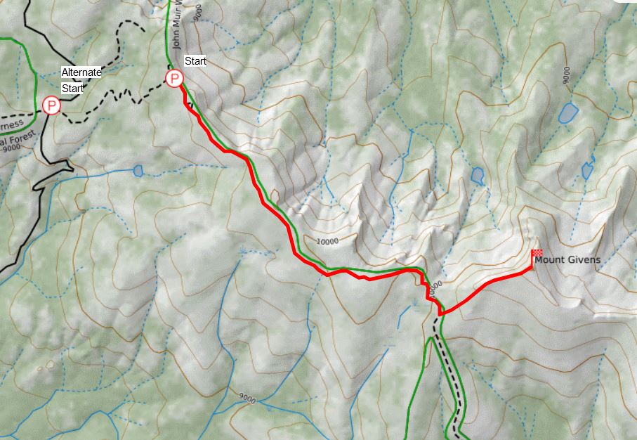
View Trail Map On CalTopo.com
Download Trail Map PDF
The hike to Mount Givens starts at the White Bark Vista. White Bark Vista is accessible via a 1 mile rough dirt road that leaves from Kaiser Pass. The road requires moderately high clearance. We drove it without issue with our 2015 Subaru Outback. If you don’t have a vehicle with sufficient clearance you can park at Kaiser Pass and hike to the vista. It adds 2 miles round trip and 500 feet of elevation gain this way.
From the White Bark Vista we started hiking the dirt road southeast. Soon we reached a gate that seasonally opens (Aug 1. – Nov. 1) to allow off-road vehicle access to the Dusy-Ershim OHV Route that we were hiking on. You would need a seriously intense off-road vehicle for this. I was impressed that anything could get through it.
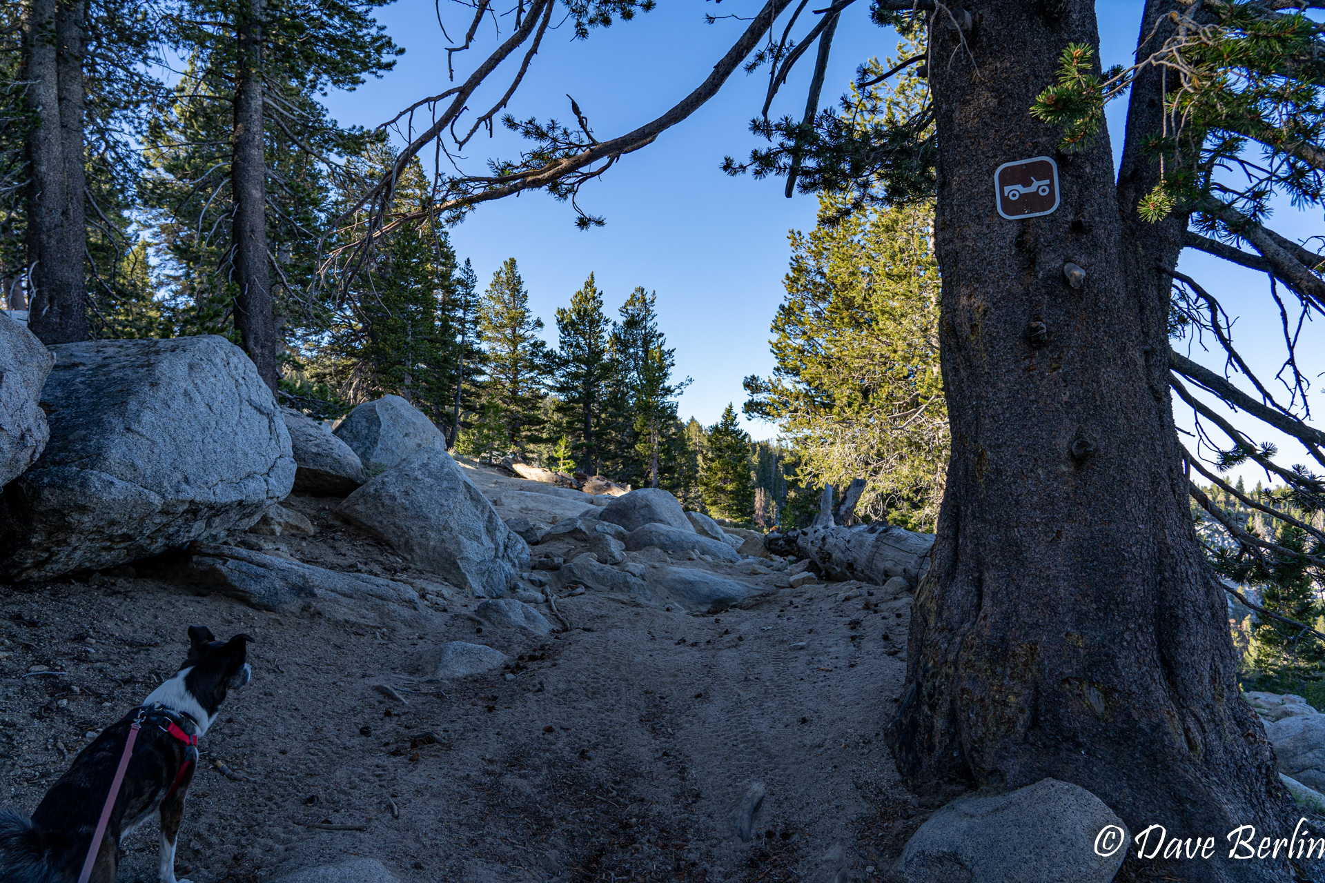
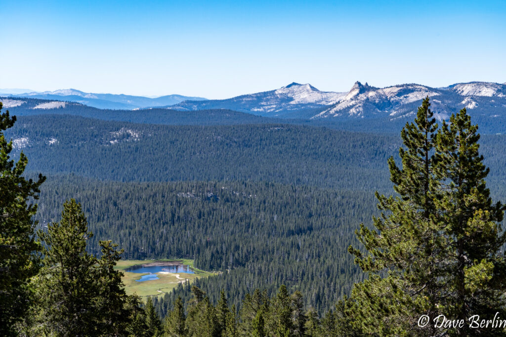
The dirt road rolled up and down on the slopes beneath the ridge. The ridge blocked the epic views to the north and east, but the hike was still very pretty and enjoyable.
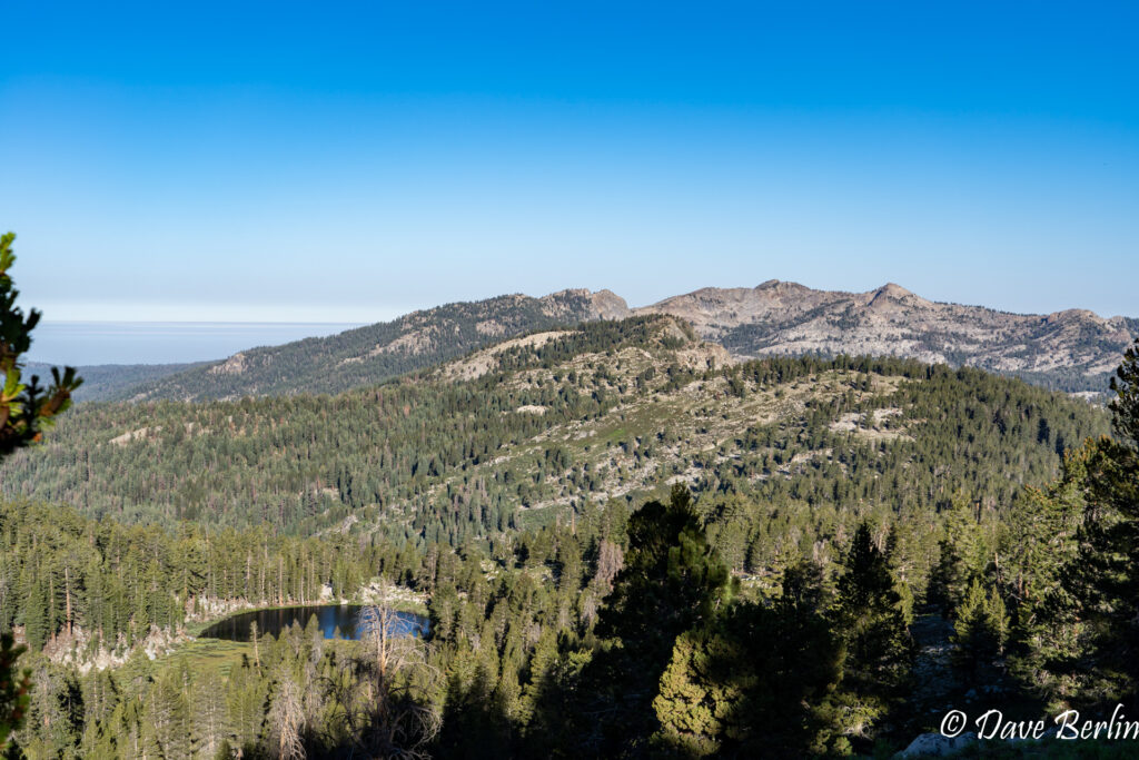
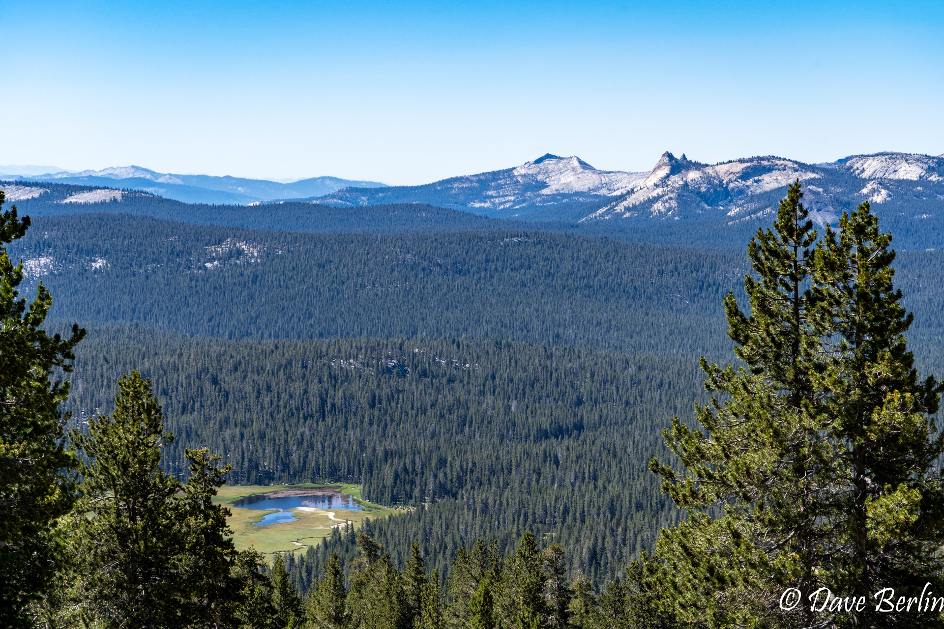
Deer Lake and Kaiser Peak on the way to Mount Givens 
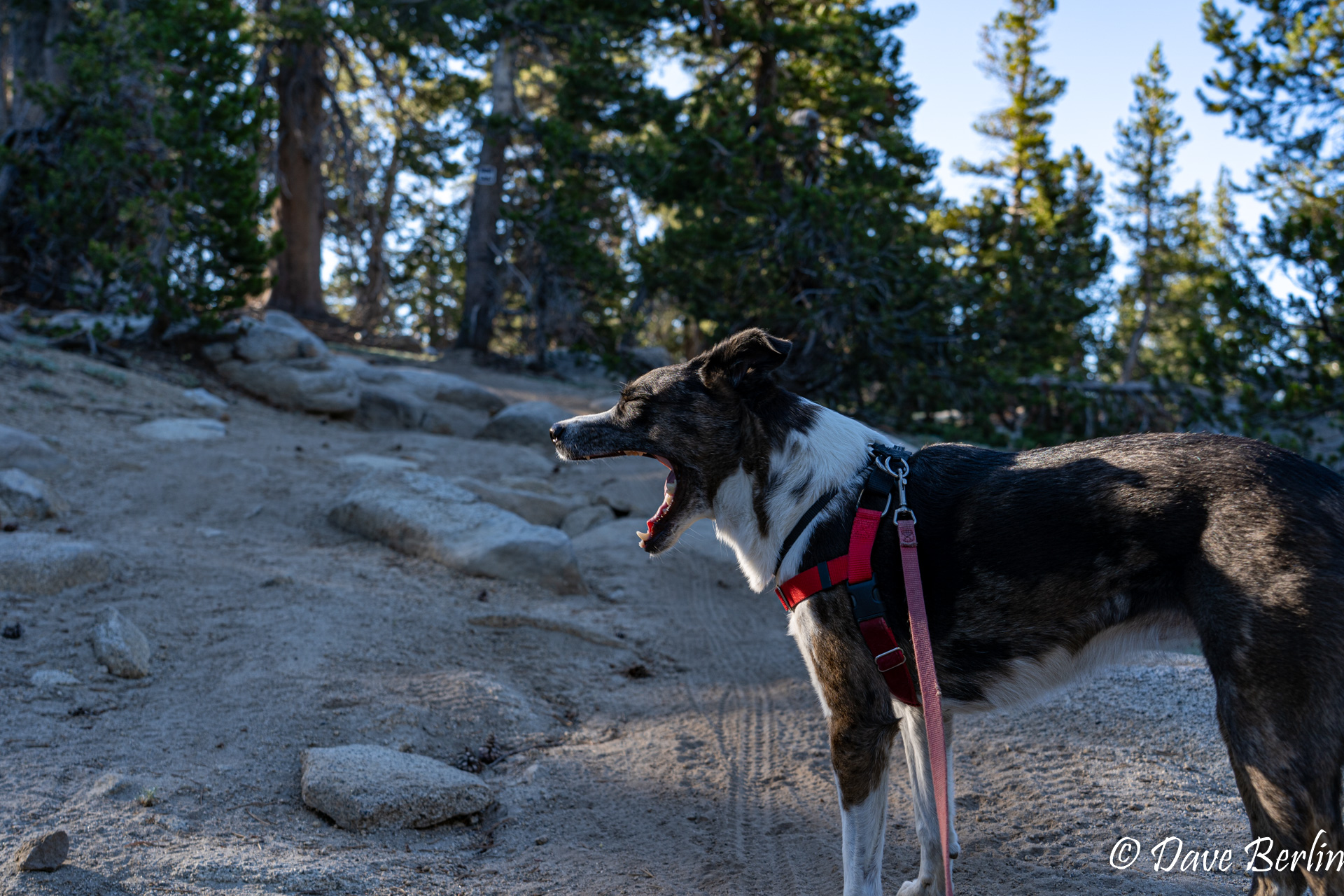
Heidi yawning on the way to Mount Givens 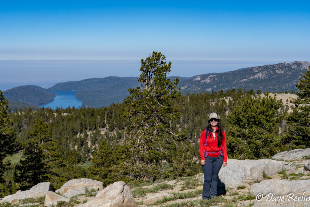
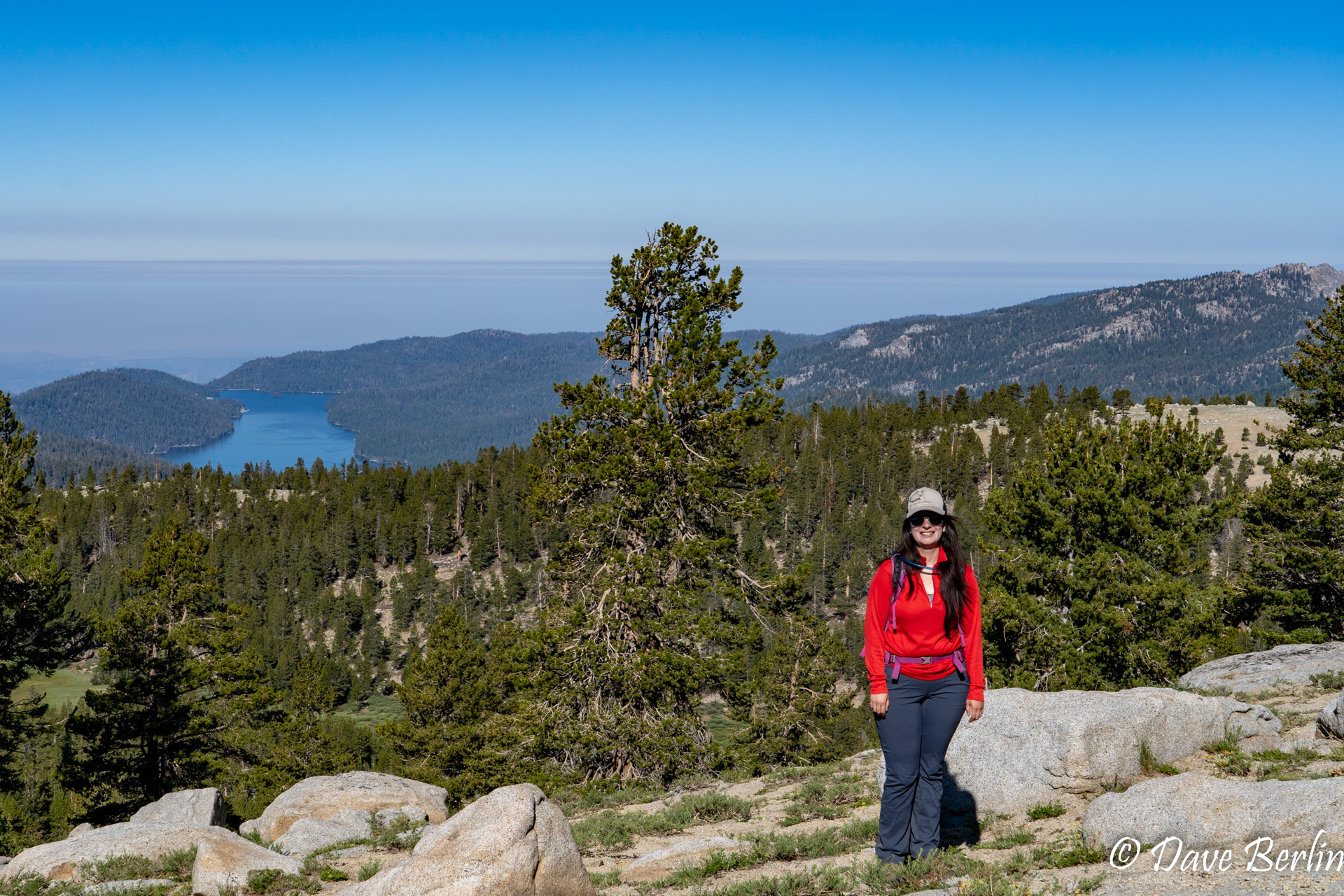
Alexa on the way to Mount Givens with Huntington Lake behind

The was one section where the road cut downhill and a secondary hiking path continued traversing straight ahead. We followed this secondary hiking path and were glad we did. The hiking path was more direct and skipped some unnecessary elevation gain on the road.
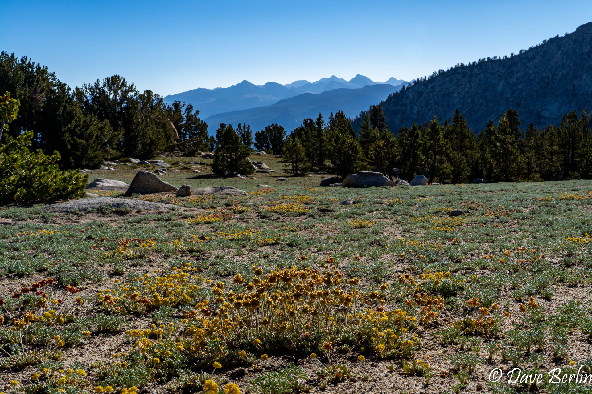
As we continued, the forest became sparser and was filled in with very short ground cover including a few wild flowers (a type of Buckwheat I believe).

Wildflowers and mountain views on the hike to Mount Givens
Nearing the western slopes of Mount Givens, the road turned to the south. We started looking for a good place to leave the road and head up towards the peak. We didn’t see any signs of a trail so we picked a spot and headed up cross-country. The terrain wasn’t too steep, but we learned on the way down that there was an easier way. A little farther south the terrain was less steep and a little easier. It didn’t seem like anywhere on the route was very difficult though if we didn’t find the best path.
We hiked up the western slope until it was convenient to gain the west ridge.
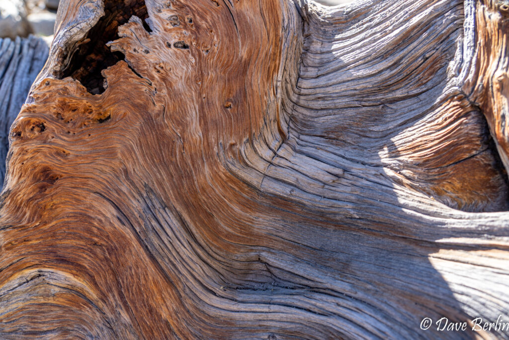
Close up of beautiful dead tree on Mount Givens 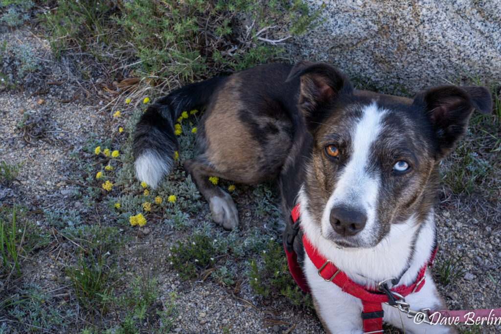
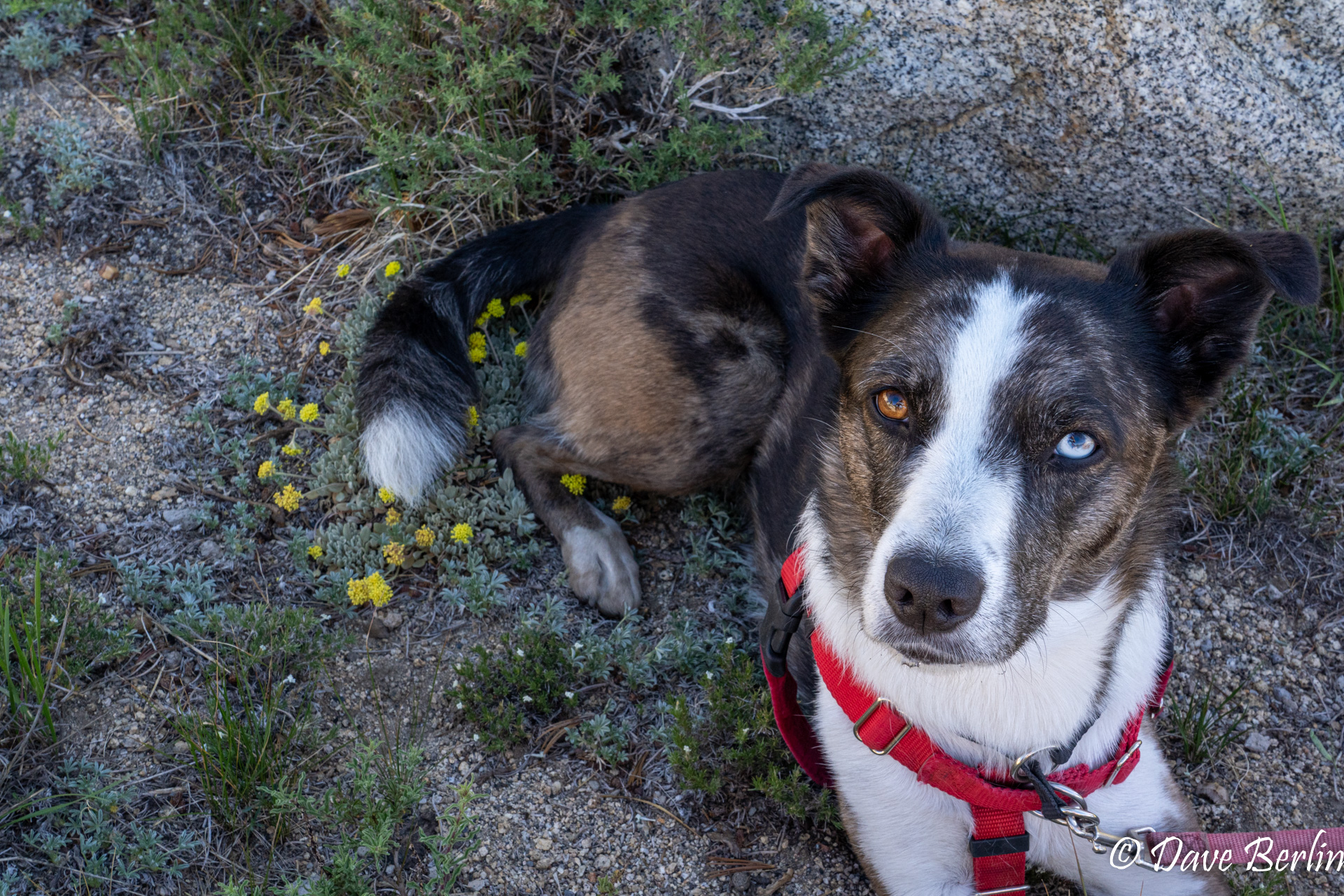
Heidi taking time to stop and sit on the flowers 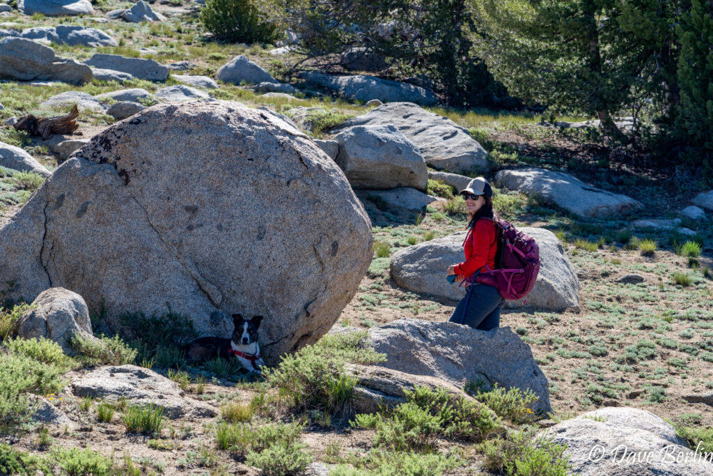
Heidi taking a break in the shade on Mount Givens


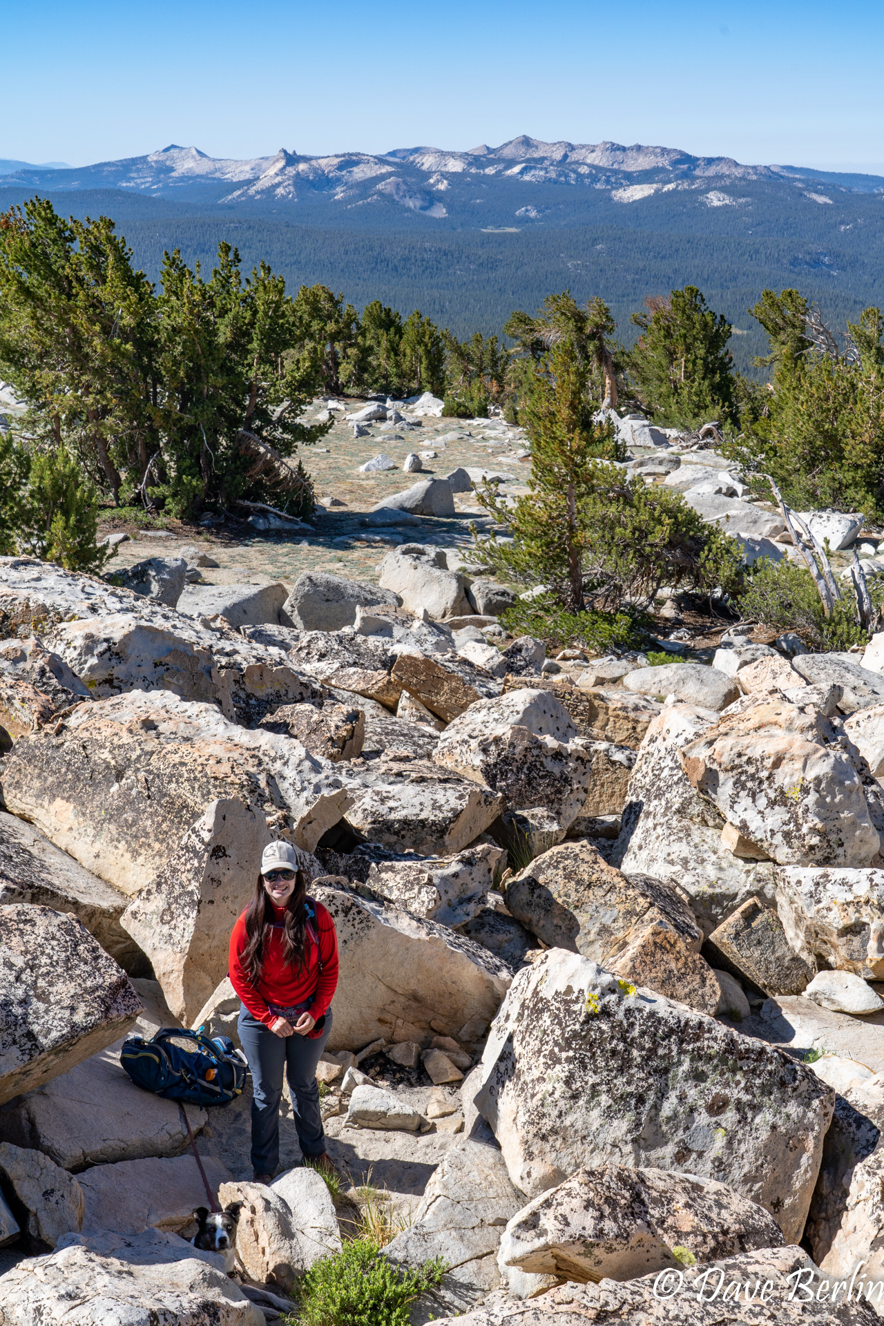
Another 20 minutes on the ridge and a short section of talus hopping led us to the rocky summit of Mount Givens. The views were amazing, but the very top was swarming with flies. This was the second time I’ve run into an inexplicable swarm of flies at the very top of a peak. Weird!
There wasn’t any shade so we didn’t spend too much time hanging out on the summit (plus the flies!). We took a short break and headed back down.
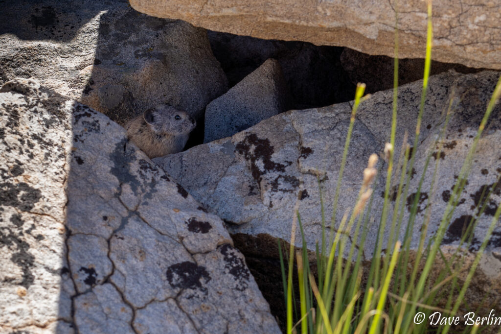
Pika on the summit of Mount Givens 
Alexa and Heidi on the summit of Mount Givens

[pano file=”https://flagtails.com/wp-content/uploads/panoramas/mount-givens-pano/mount-givens-pano.htm” width=”100%”]
The way down was pretty straightforward, but we had to fight the urge to go the wrong direction. Following the natural downhill slope of the terrain would have brought us way farther south and off the route we wanted. Angling skiers right on the way down felt almost unnatural, but it kept us going west and in the correct direction.
Back at the road we reversed our track, made our way back to the car at White Bark Vista, and ate a well earned lunch. We were hungry too, because we forgot to bring any food on the hike, oops!
Dogtooth Peak, Eagle Peak, and Lakecamp Lake from Mount Givens 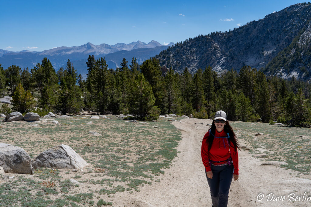
Hiking back from the summit of Mount Givens