Eldorado Peak is a striking glaciated peak in North Cascades National park in Washington state. It has a unique knife-edge snow ridge at the summit and dramatic views of the surrounding mountains. I climbed the East Ridge route in a party of 4 over two days in June 2019.
Disclaimer: This is a post of an older trip but the scenery was so amazing that I thought this trip deserved a post. Some of the pictures were taken by my friend Ethan as indicated in the image watermarks. I only had a small point & shoot camera on this trip so some of the images aren’t as high quality.
Stats:
Type of Climb: Glacier/Snow
Location: North Cascades National Park, Washington
Mileage: 7.9 Miles Round Trip
Elevation Gain: 6,956 Feet
Summit Elevation: 8,868 Feet
Useful Links:
Driving Directions to Trailhead (Google Maps)
Summit Weather Forecast (Mountain-Forecast.com)
Eldorado Area Climbing Conditions (National Park Service)
More Info (Summit Post)

View Trail Map On CalTopo.com
Download Trail Map PDF
We drove the the trailhead via Highway 20 and Cascade River Road, stopping on the way to pick up our permit from the ranger station. The rangers actually recognized Ethan’s name. “Hey, you’re the guy with a bunch of permits for this summer right?!”
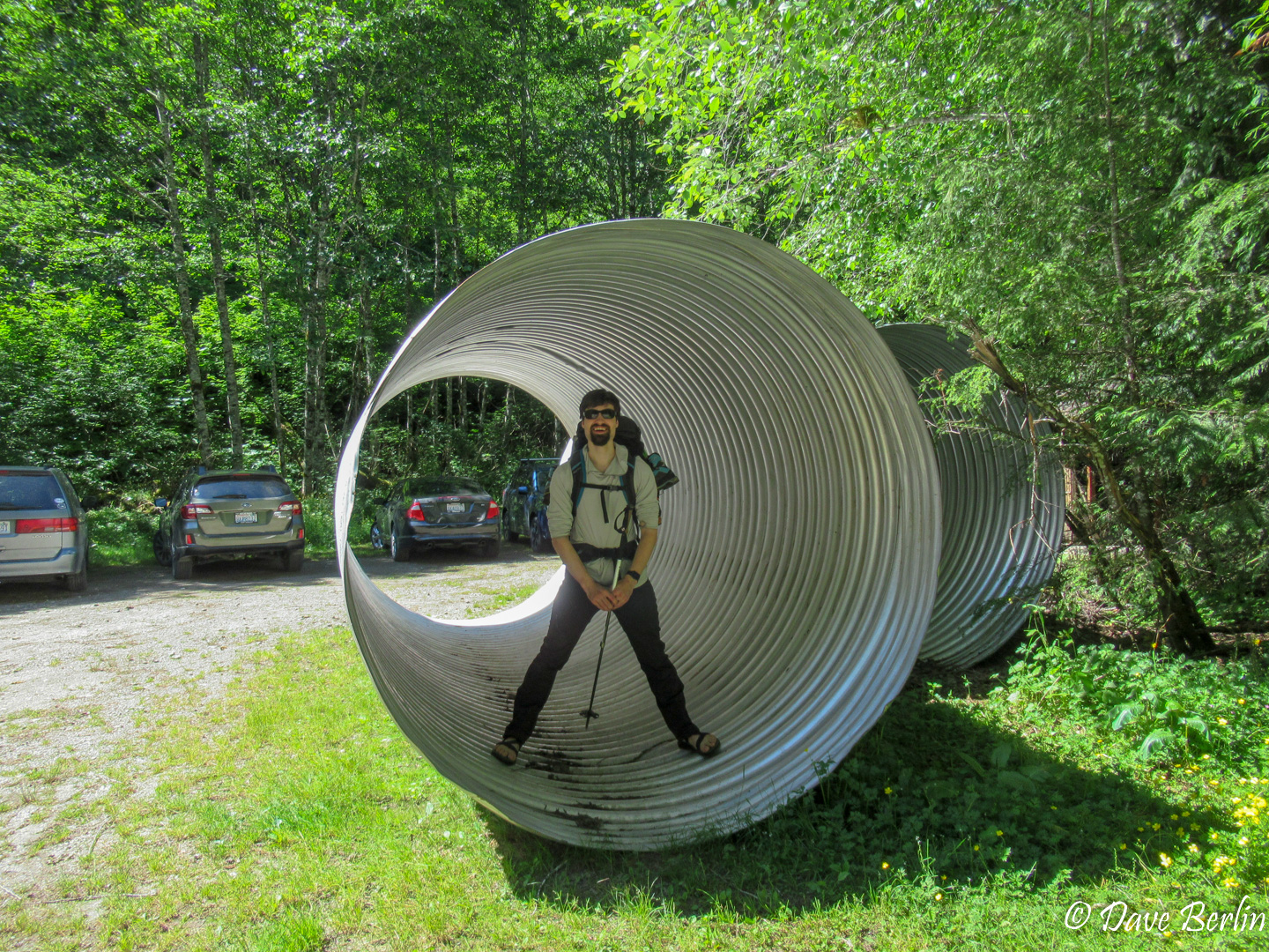
At the trailhead there were some giant pipes that we briefly goofed around in before we headed out.
The trail stared out immediately with crux number one: crossing the North Fork of the Cascade River. In the past there was a large slippery log to cross on, but it washed away a few years ago. Now there might be a cairn to mark the easiest crossing. When we were there it was more choose-your-own-adventure style. Pick a spot and cross. We found a shallow enough spot pretty close to the parking area and went for it. COLD! The river was swift and freezing. It was the kind of cold that made your feet lose feeling and scream in pain at the same time.
Once across the river we did some light bushwhacking to find the main trail. Pay attention to where you crossed and how to get there from the trail. On your way back to the car it might not be obvious. There was a trail register/sign post that could serve as a good landmark if you find it. We didn’t see it on the way up but ran into it on the way back.
The unmaintained trail ran steeply up the west side of the Eldorado Creek drainage in the forest for a while. The trail was mostly easy to follow but it was far from the most fun part of the trip. No views, uphill through the forest, with fully loaded packs, boo! Eventually we broke out of the thick forest and started to get some hard-earned views behind us.

After a short third class scramble section, we made it to the next stage: long boulder fields. This is where I was really glad I brought approach shoes in addition to mountaineering boots. Semi-flexible soles and the ability to bend at the ankle made the boulder hopping much more tolerable. On the way up we didn’t see any critters around, but Marmots were all over on the hike down in these sections. I didn’t take any pictures on the way up so these are from the same area but on the way down.
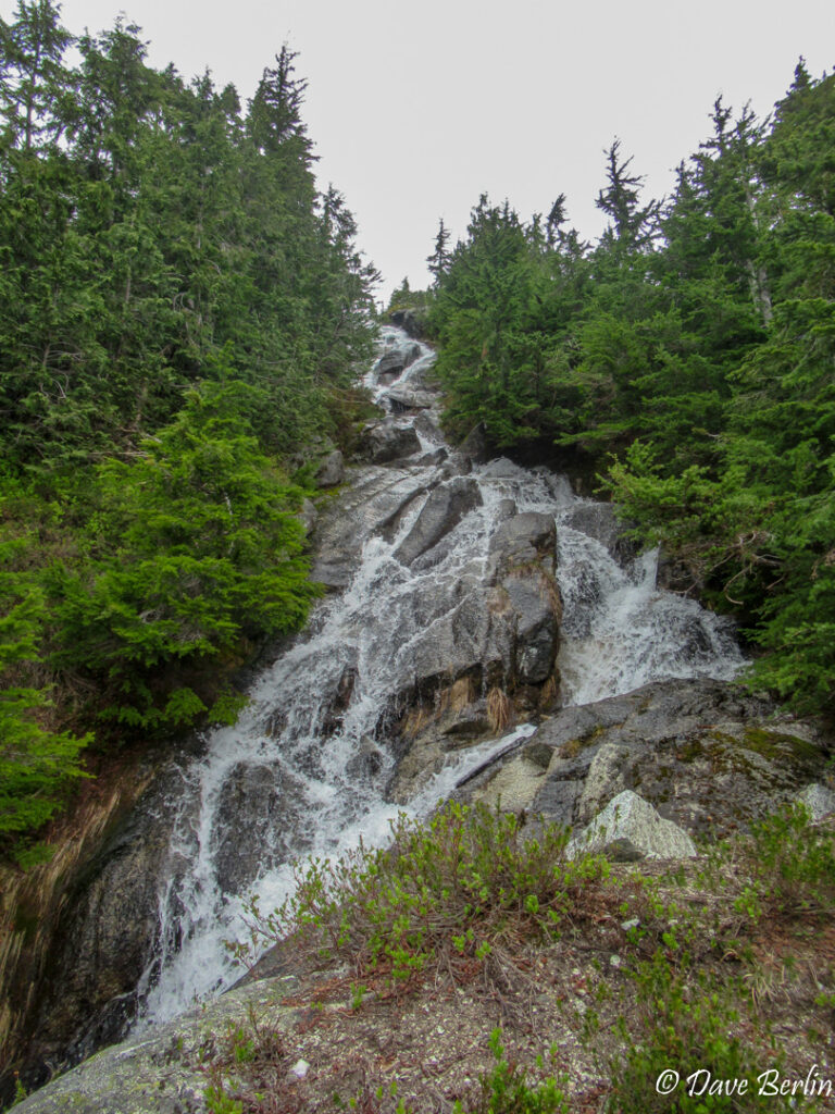
Waterfall near the top of the boulder fields 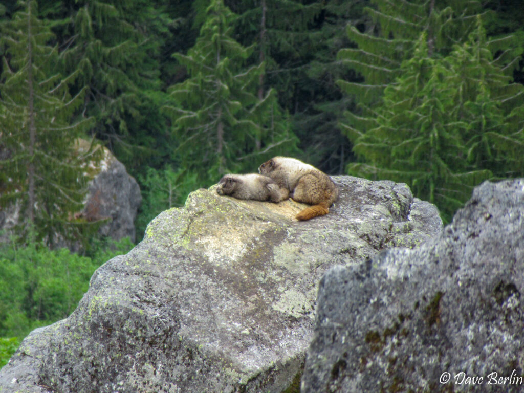
Marmots in one the boulder fields 
Marmot in one of the boulder fields


As the boulders subsided, trees and alpine vegetation started to take over. The trail was surprisingly muddy in this area. We hiked higher and into the Eldorado Basin and angled up towards the ridge that separated the Eldorado Basin from the Roush Basin.
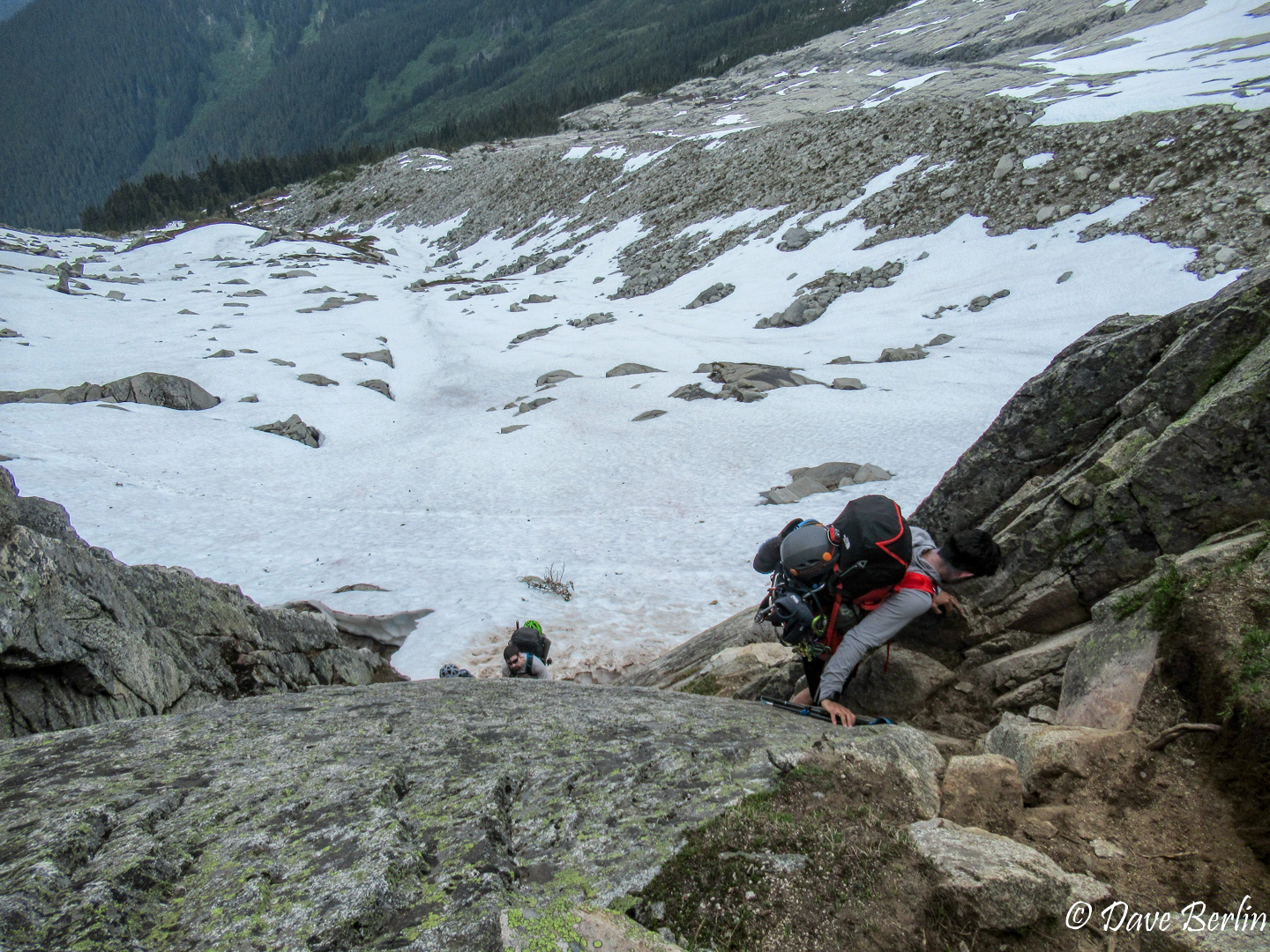
The next crux, and perhaps the most technical part of the route, was descending from the top of this ridge into the Roush Basin. It was a third class down climb on rocks and steep dirt. On the way to camp we actually went slightly off-route by cutting down too soon and not hiking up the ridge enough. It still went ok, but it meant traversing some extra snow slopes in approach shoes.

The short scramble down the ridge to the Roush Basin 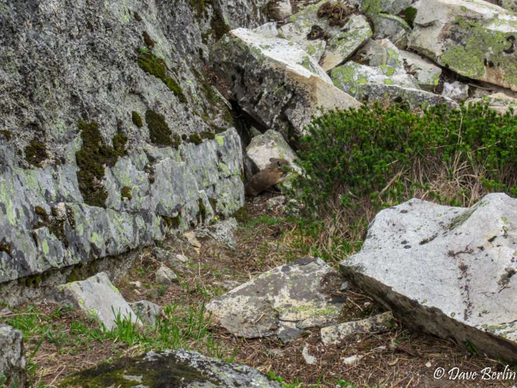
Pika in the middle of the scramble down to the Roush Basin 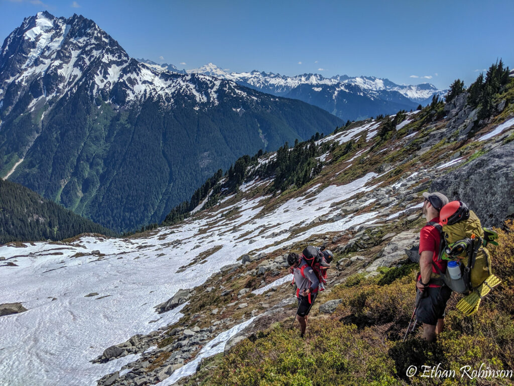
Looking down the Eldorado Basin towards Johannesburg Mountain


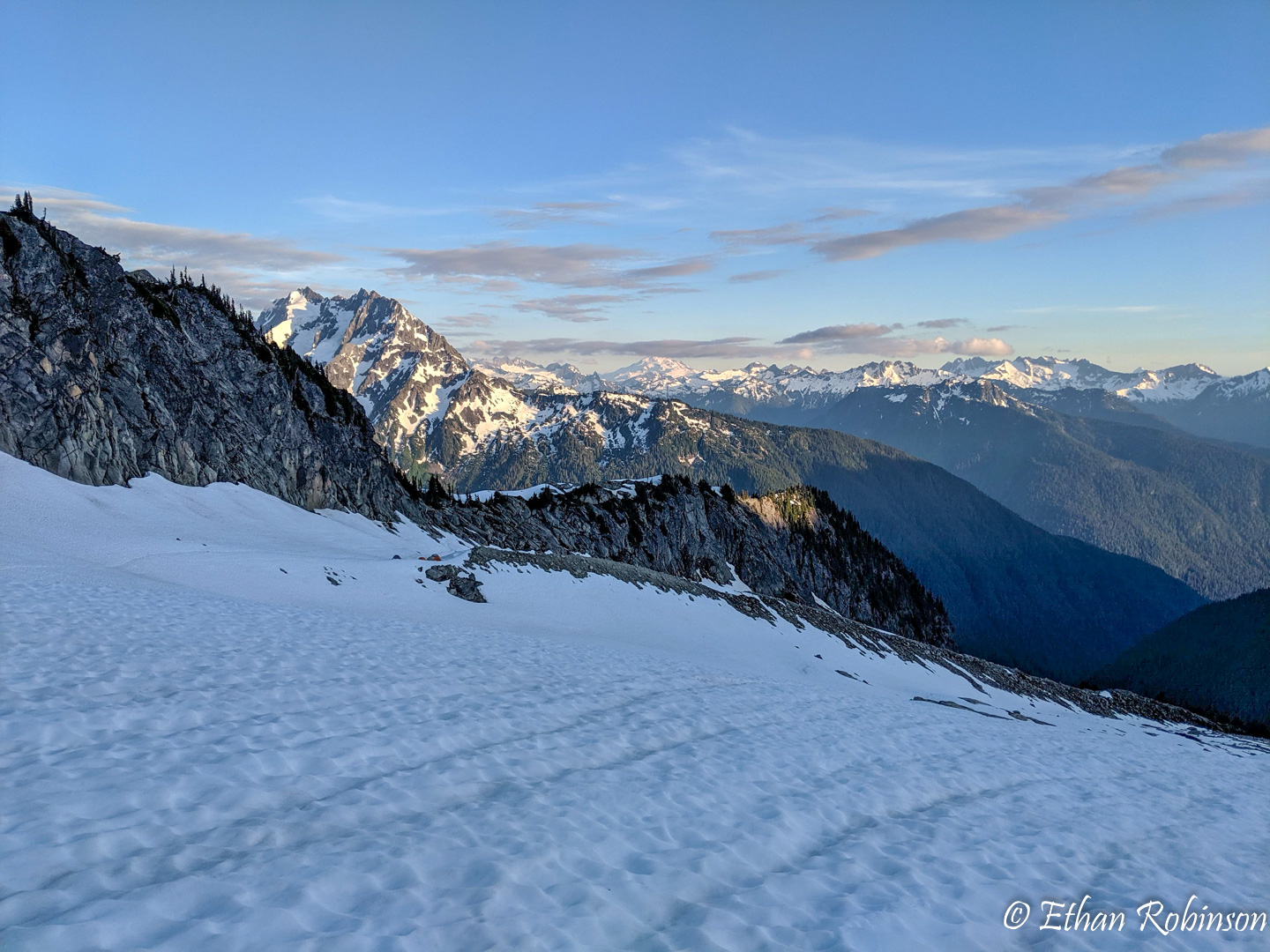
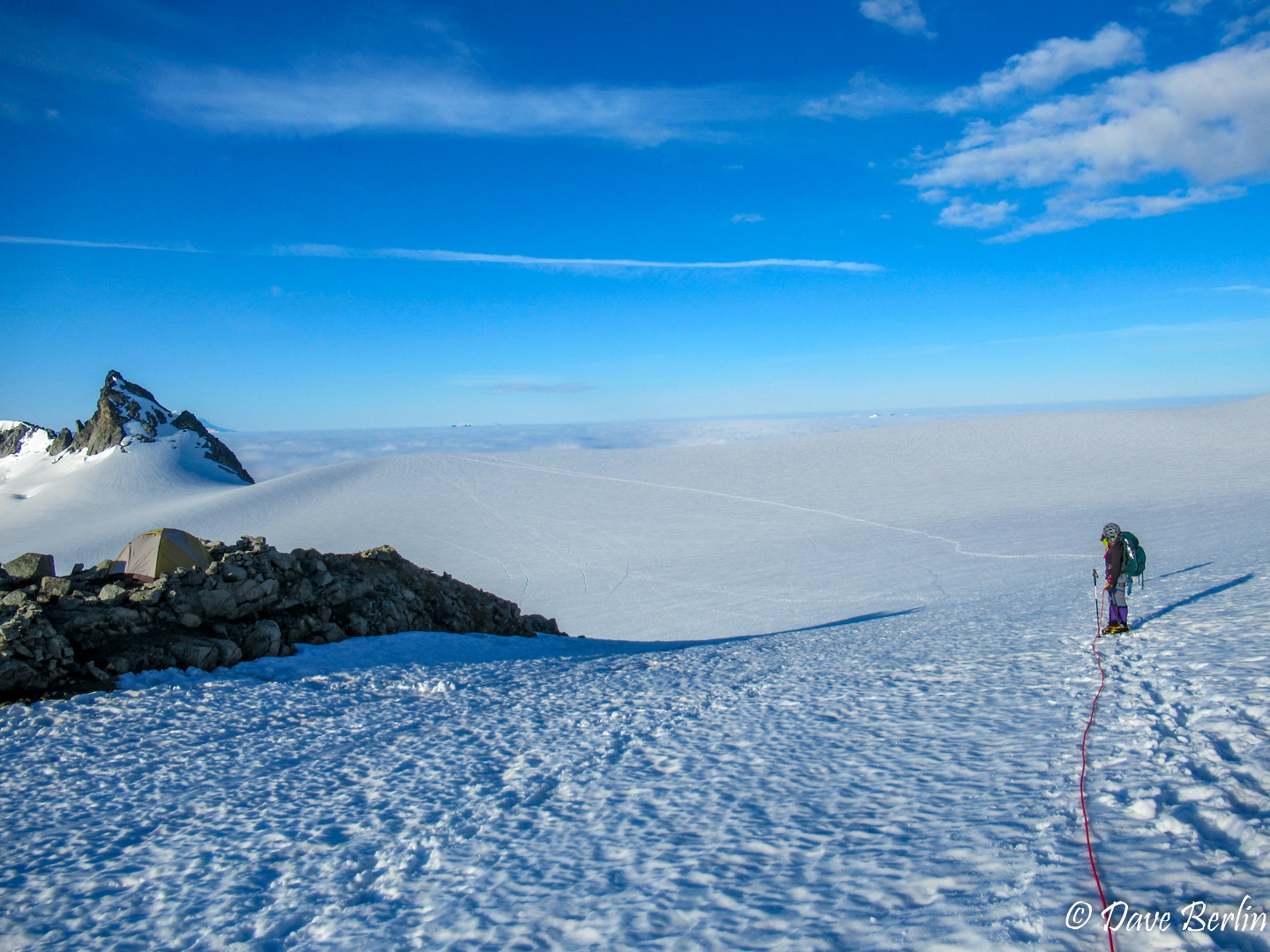
Once in the Roush Basin we looked for a nice spot to camp. If we kept climbing too much higher we might have gotten onto the glacier and we didn’t want that. There were a couple close by camp spots on a moraine but they were occupied so went a little higher to a nice flat area on the snow and set up. It was a beautiful camp with views of Glacier Peak, Snowking Mountain, Hidden Lakes Peaks, and more. There was a lot of snow but there was one exposed rock with water running down it that we were able to get water from without melting snow.
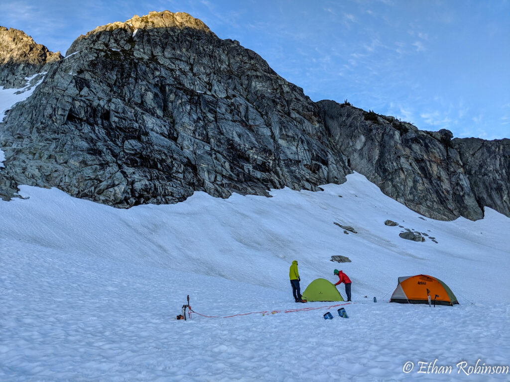
Setting up camp in the Roush Basin en route to Eldorado Peak 
Roush Basin and Johannesburg Mountain

We settled in for the night and tried to get as much sleep as we could. From camp, we were only ~3,000 feet and 2 miles from the summit. This meant we didn’t have to get the earliest of alpine starts.
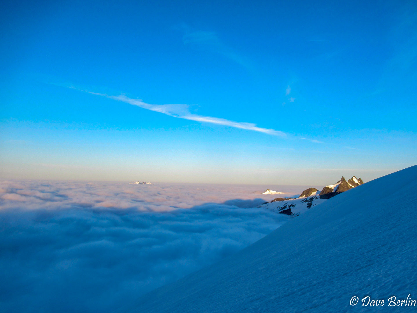
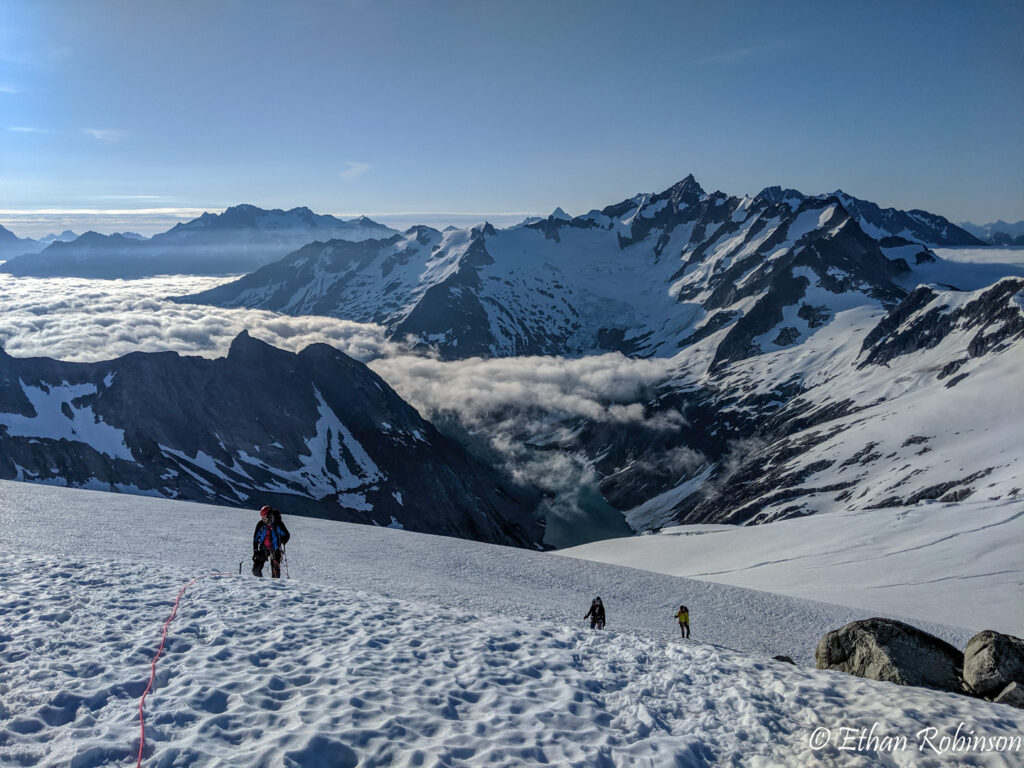
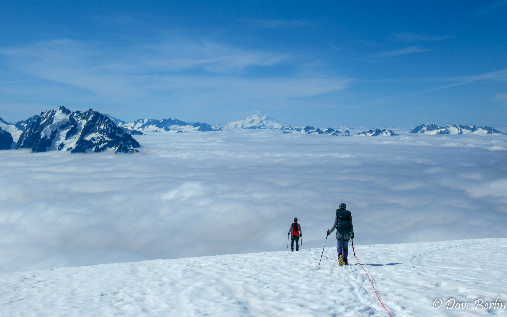
We woke up sometime around 4am and the camp was going in and out of the clouds a bit. I was a bit worried we would be in the clouds for most of the climb, making navigation harder and blocking any views. Thankfully we climbed above the cloud layer shortly after starting out in the morning.
Heading up the lower reaches of the Eldorado Glacier there was excellent snow coverage everywhere. We couldn’t tell where the glacier actually started and there were virtually no signs of crevasses. This made for easy and quick travel conditions.
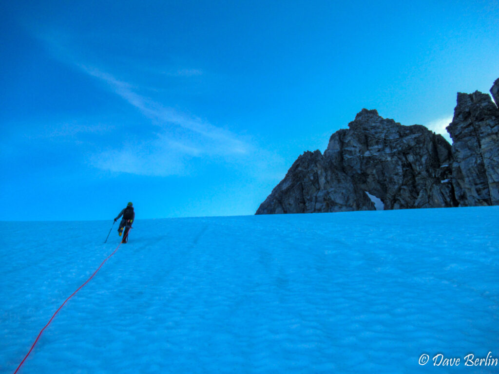
Heading up the Eldorado Glacier at dawn 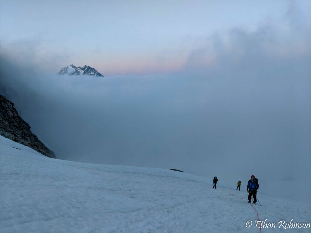
Climbing above the clouds on the Eldorado Glacier at dawn 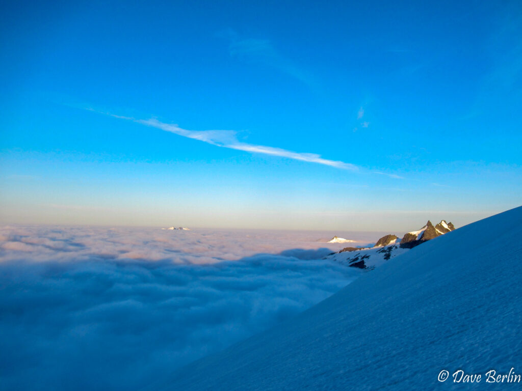
Climbing above the clouds on the Eldorado Glacier at dawn


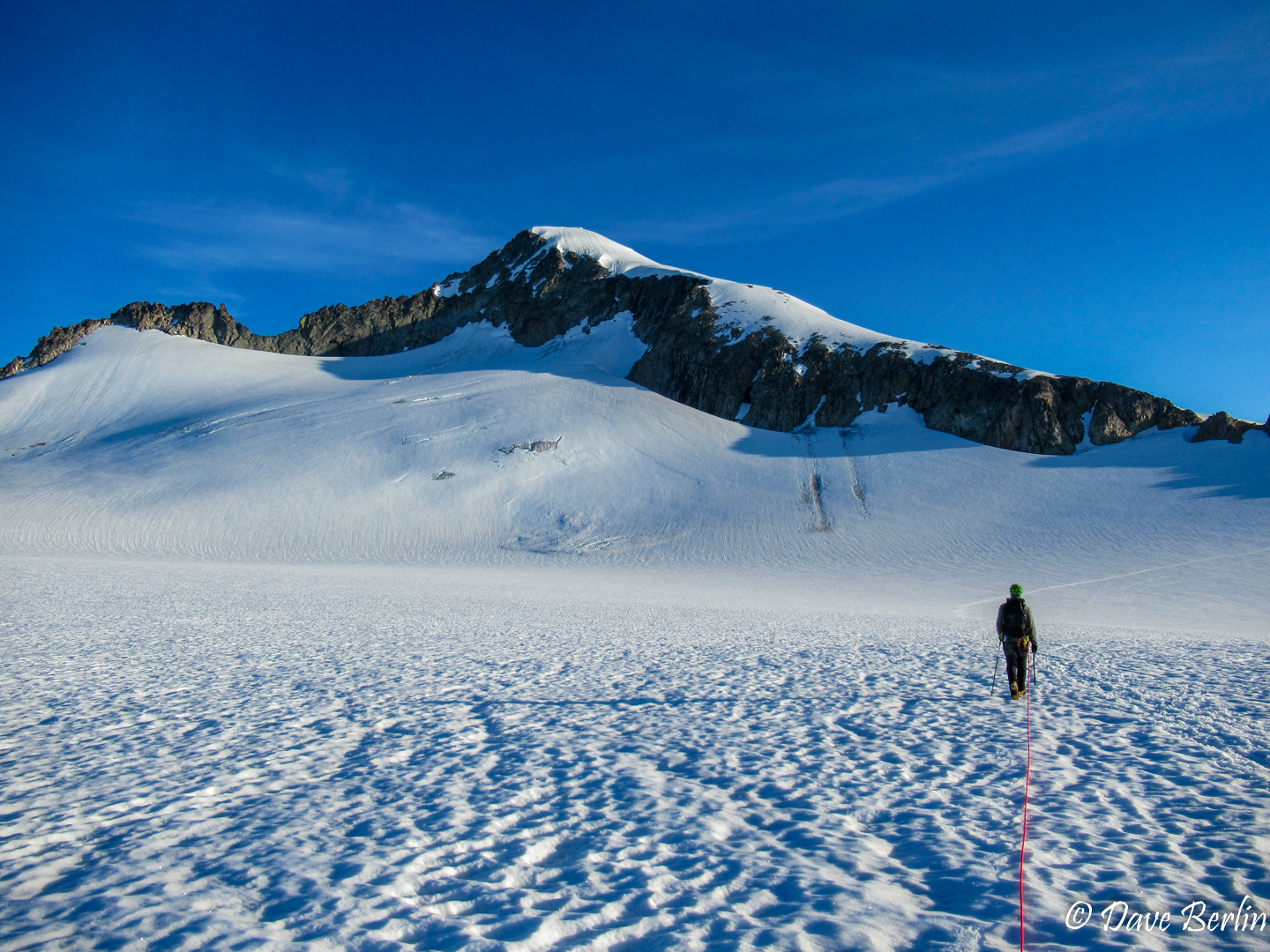
About 1.5 hours after starting we crested the Eldorado Glacier and pulled onto a huge flat Inspiration Glacier below the summit. This was the first time we could see Eldorado Peak proper so excitement was in the air.
We followed a boot path across the vast glacier towards a low notch in the east ridge of Eldorado. At the ridge there was a few snow free campsites in the rocks that looked even more spectacular than our camp. These would have required climbing up the glacier with full backpacks though so one would really have to earn those views!
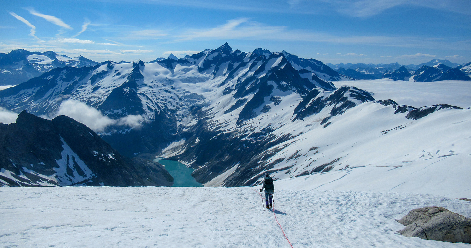
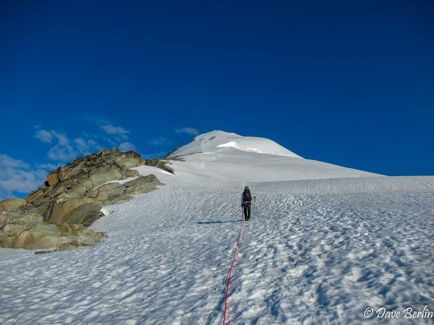
Once on the ridge we climbed straight up towards the summit. The ridge undulated a bit with a few steeper sections, but overall it was still easy terrain. The views looking behind us were unbelievable. Cloud covered valleys, epic glaciers, a creamy blue lake, and angry dark mountain peaks. This was one of the most incredible places I have ever been.

Crossing from the Inspiration Glacier onto the east ridge 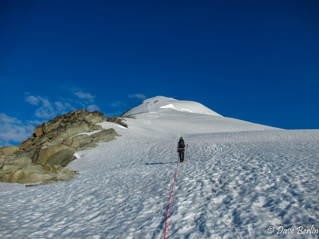
Climbing the east ridge of Eldroado Peak
Looking back while climbing the east ridge of Eldorado Peak 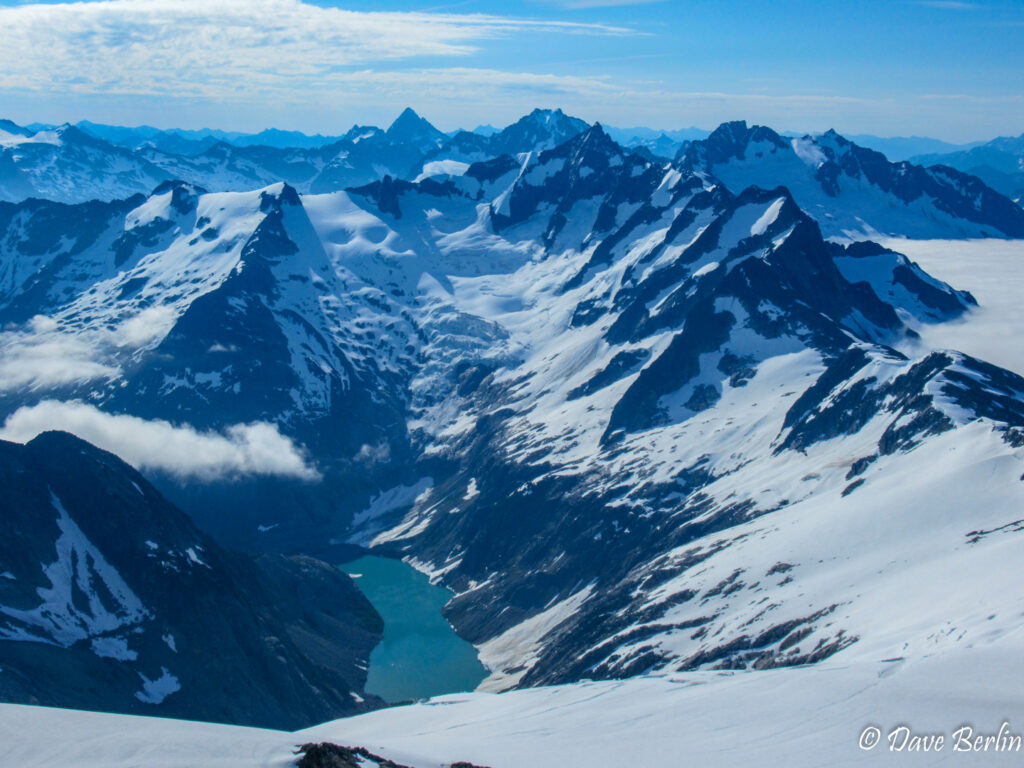
Forbidden Peak and Moraine Lake from Eldorado Peak


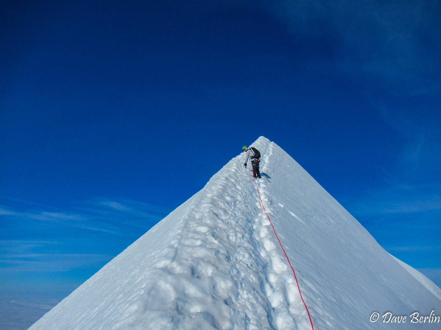
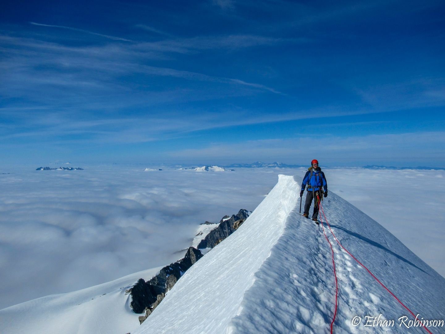
We crested another short steep snow section and there it was, the knife-edge snow ridge. There was a boot path just below the peak of the ridge. Ethan lead the way to the summit. I followed and made a point to walk as close to the peak of the ridge as I could. The feeling of exposure was tremendous and gave me that mix of adrenaline, fear, and excitement that I love to get in climbing. We all grouped up on the summit to take a break, high-five, and enjoy the spectacular view.

Ethan leading the way up the snow ridge 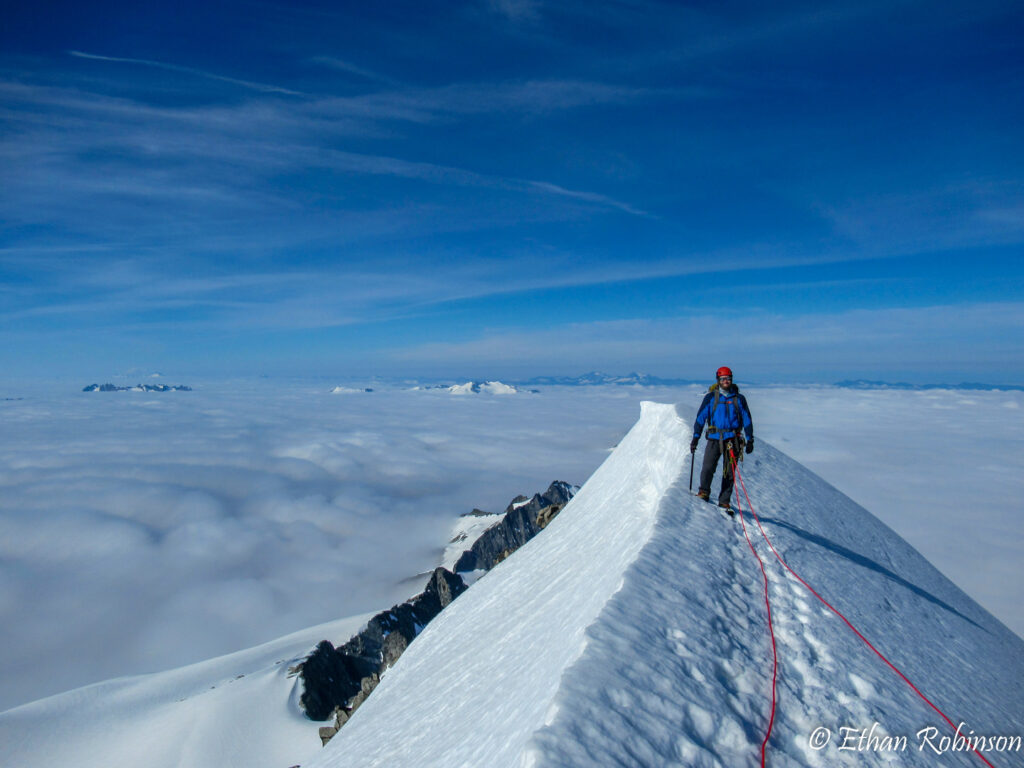
Me on top of Eldorado Peak 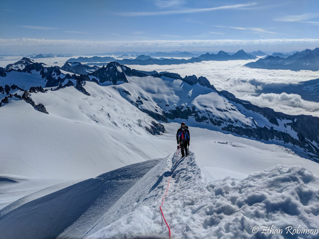
Me walking on the knife-edge snow ridge of Eldorado Peak

[pano file=”https://flagtails.com/wp-content/uploads/panoramas/eldorado-peak-pano/DSC_0584.htm” width=”100%”]
We reversed the route, heading back the way we came. This direction we got to gaze at the expansive views even more than on the way up. The clouds still hung over the valleys into the distance, making it feel like we were high on a mountain peak in the middle of a vast ocean.
We descended down to camp, which was at the edge of the clouds. It ended up being nice to finish the hike back to the car under the clouds. It was a warm day with little wind so we were happy to have some shelter from the sun.

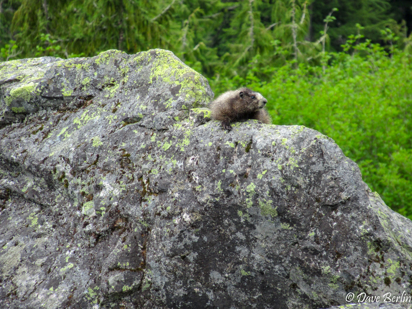
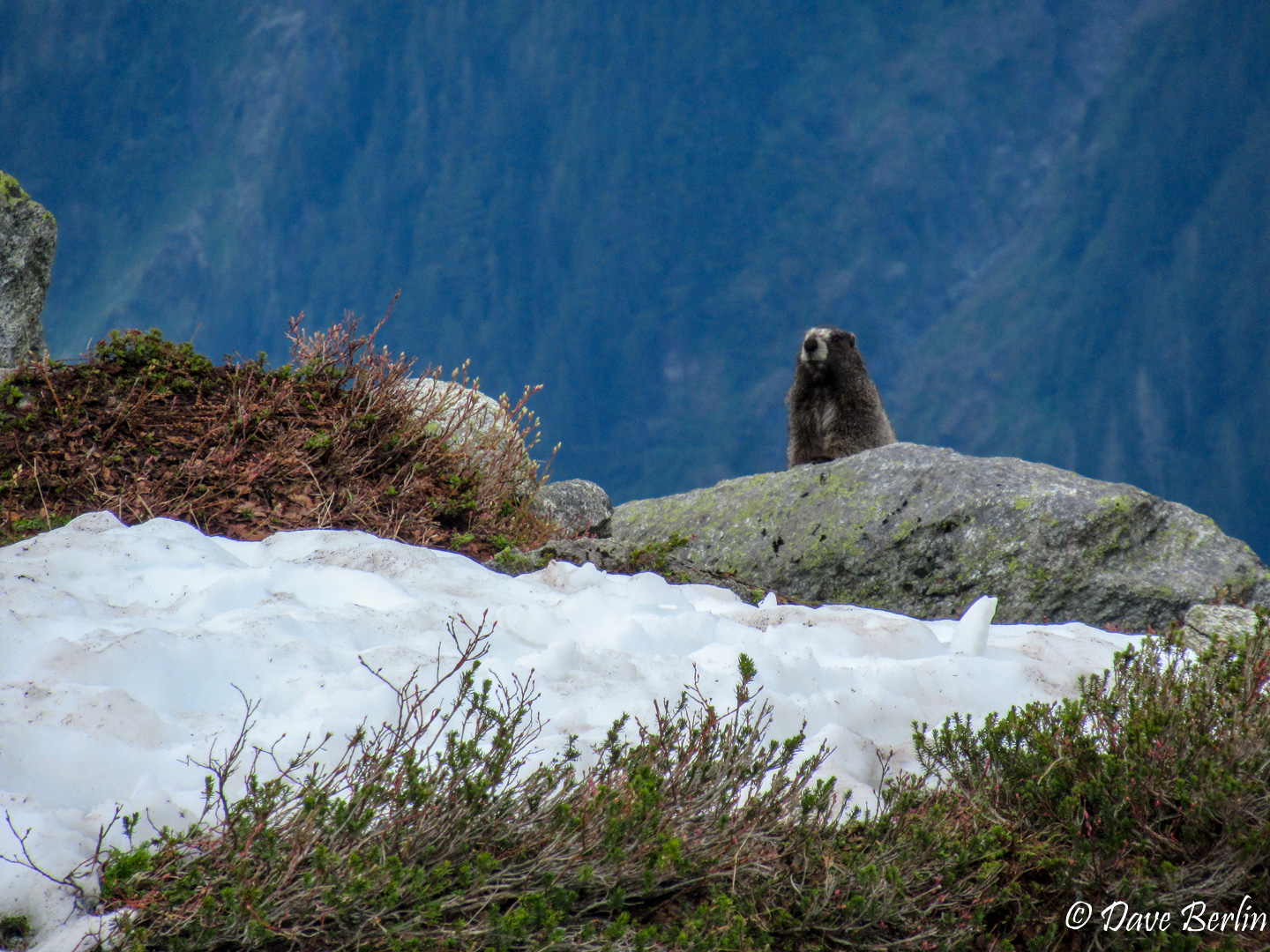
Marmot checking us out on the hike down from Eldorado Peak 
Marmot checking us out on the hike down from Eldorado Peak

When we finally made it back to the river we had a hard time finding our crossing. The main trail lead us to where the log used to be, but that wasn’t a good spot to cross. Exhausted and ready to be at the cars, we spent 10 minutes backtracking and bushwhacking while trying to retrace our steps from a day and a half ago.
At some point I thought I might have recognized a log/tree area. I followed a path using vague hints of intuition, half thinking I was on the right track, half thinking I was making things up. Amazingly I ended up being right, and we found our stashed flip-flops and the river crossing we used before. One more ice cold river crossing led us to the cars and to the long drive back home.